GIS and Remote Sensing
Classification of Remote Sensing Data
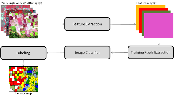
Classification is one the classical remote sensing applications used for land cover mapping and monitoring. We used single or multi-sensor remote sensing data for land cover classification and mojor tasks include but not limited to;
- Land cover classification for map generation
- Discrimationing different ground targets
- Object based image segmentation
Methods
- Supervised classification (SVM, Random forest, Decision tree, Extreemly randomized tree, etc)
- Unsupervised classification (K-mean and the ISODATA clustering algorithm)
- Hybried methods
Tools
Python, IDL, C/C++, Matlab, R, ArcPy, machine learning libraries